
The residential hub of Coopers Plains is on Orange Grove Road between Musgrave Road to the north and Boundary Road to the south. It has so much going for it.
Our Community
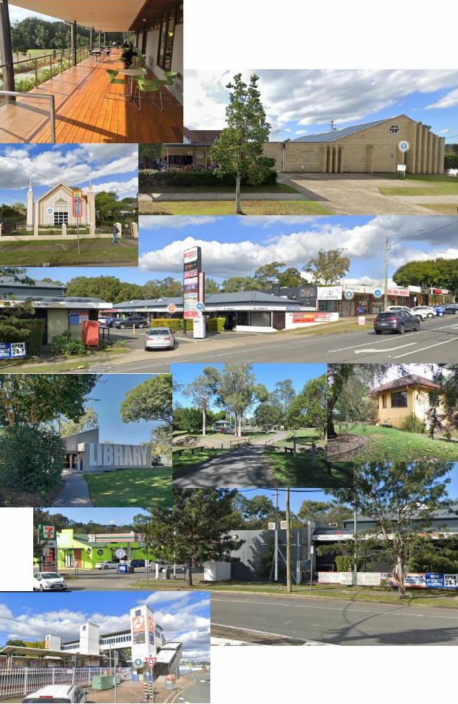
We have a library, neighbourhood centre, several churches, school (and voting booth), child care centres, gym and several shops including a petrol station, medical centers and a supermarket. Behind the shops is Stable Swamp Creek and our park, named for local historian Beryl Roberts. Nearby is Coopers Plains railway station and our post office. But it has a problem.
Our History
Coopers Plains is one of Brisbane’s earliest outposts. It started in about 1826 as the Moreton Bay Penal Settlement’s first crossroad between Brisbane town, Ipswich, Logan and Cleveland.
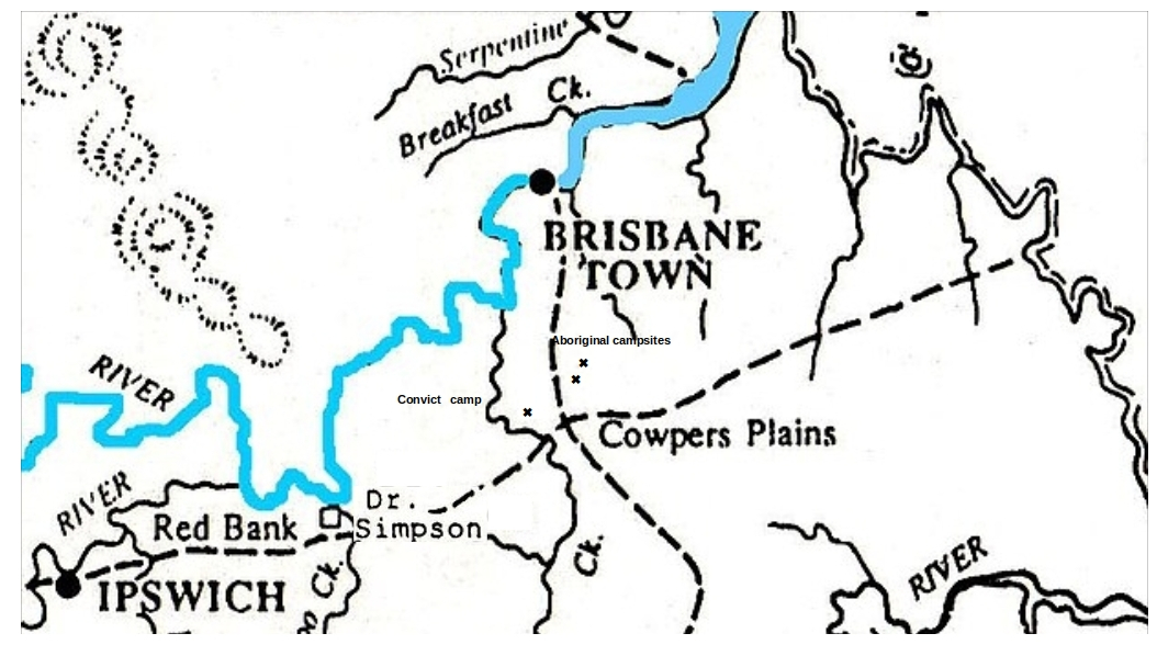
A government station in the form of a slab hut was built for a convict road-gang. We think the station hut was somewhere south of the present day intersection of Beaudesert Road (the oldest road through the area) and Granard Road.

A brief history of traffic flow
Transport was on the rivers and waterways until it transitioned to land tracks. Some of these convict built tracks followed ancient Aboriginal tracks. In 1840, after the Penal Settlement had been closed and Brisbane was opened up to free settlement, the earliest Coopers Plains locality grew up in present day Acacia Ridge on Beaudesert Road, between Mortimer Road and Elizabeth Street. There was a hotel, racecourse and shops. In 1873 the Coopers Plains State School was opened on Beaudesert Road, which is now the Aboriginal and Islander Independent School, otherwise known as the Murri School.
Then came the railway in 1885. With more people, a township became focussed [sic] around Coopers Plains station where the present day Henley Street shops are.
Then, when automobiles became common, roads developed. Beaudesert and Logan Roads were the main routes south from the city to the Gold Coast. Boundary Road continued to be a major east/west connection through Coopers Plains to the Bay.
A Tale of Two Suburbs
Early housing estates and shops sprung up in both Salisbury and Coopers Plains near the train stations. A comparison is noteworthy; Salisbury spread east from the railway line along Lillian Avenue to Orange Grove Road. Coopers Plains had shops on the west side of the line, but houses were built on the other side, spreading east to Orange Grove Road and beyond. Salisbury has had the good fortune of being surrounded, rather than divided, by road and rail routes.
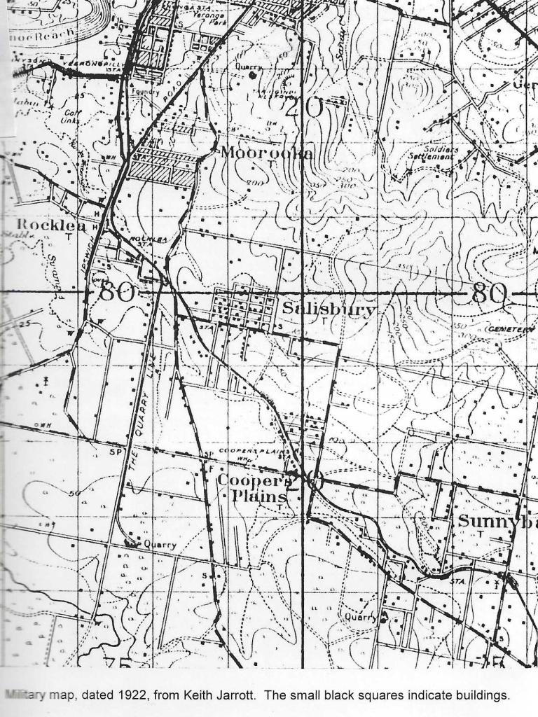
As you can see from this 1922 map, the railway line crossed both Boundary and Orange Grove Roads where they intersect.
The crossing that became Coopers Plains’ crucificial cross
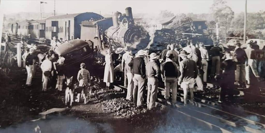
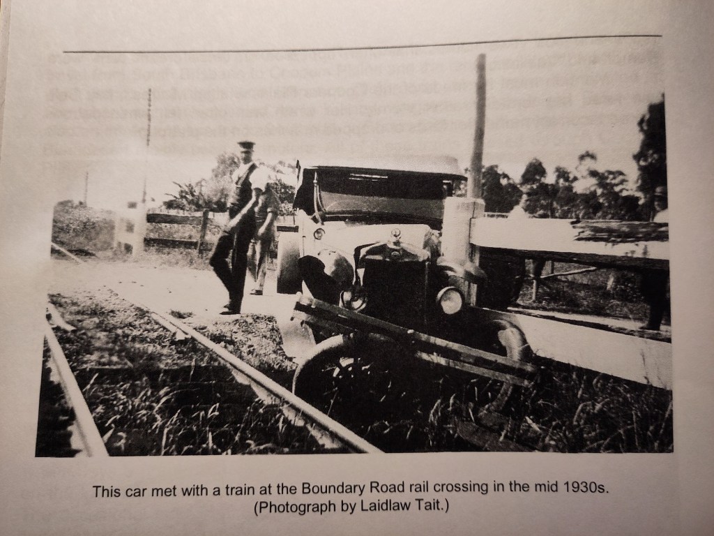
The level crossing at Boundary Road has been a danger spot for nearly a century. Stories are told of a cattle truck being hit and strewing its unfortunate load across the road in 1957. It seems this crossroad has became Coopers Plains’ cross to bear.


In the 1950s, a new road cut through the heart of Toohey Forest to connect Orange Grove Road and Toohey Road, creating a route from Tarragindi and the city to the Gold Coast via Beenleigh Road … and an even bigger headache at the level crossing. It is said that the forest road killed off all the large ground-dwelling mammals that called it home. Meanwhile, churches, shops, Coopers Plains State School and parkland were forming on both sides of Orange Grove Road. The more through-traffic fed onto Orange Grove Road, the more it drove a stake through the heart of the Coopers Plains’ neighbourhood area. Some relief must have come when the Orange Grove Road level crossing to Beenleigh Road was removed; traffic had to turn onto the Boundary Road level crossing to get to Beenleigh Road or go on to Breton Street. This must have helped calm traffic somewhat in the Coopers Plains neighbourhood area.
Some temporary relief for Boundary Road came in 1982 when Raiwena Road was opened up to join Kessels and Granard Roads in preparation for the Commonwealth Games at QEII Stadium. This is now a state gazetted heavy freight road; hence all the trucks. Boundary Road is still a City Council road.
In the 1970s and 80s, the Pacific Motorway was built to carry a huge increase in population and hence traffic from Brisbane to the Gold Coast.
Growth
Growth has brought untold improvements to Coopers Plains. However, there have been many downsides that seem to go unheeded. Elderly residents lament the loss of beautiful Stable Swamp Creek, which was once a lively watering hole they could swim in. It has been turned into a lifeless, polluted concrete canal in an ill-advized effort to mitigate flooding. Ever increasing population has always, it seems, outpaced the ability of urban planning. Maybe it’s time to focus on better, not bigger.
Less is more
The Boundary Road level crossing has defied resolution despite 50 years of resident lobbying and complaints. In 2024, onsite preparations began for an overpass. However, the overpass looks like being overkill (click link for more).

Leave a comment