

To all today, a very Merry Christmas.
Coopers Plains History Group Projects
The Coopers Plains History Group has been active on a number of fronts in recent months. We’ve made some significant progress promoting local history by nominating names for two parks (see below) after – no, not people, but – projects in the past that made quite an impact on the local surrounds.
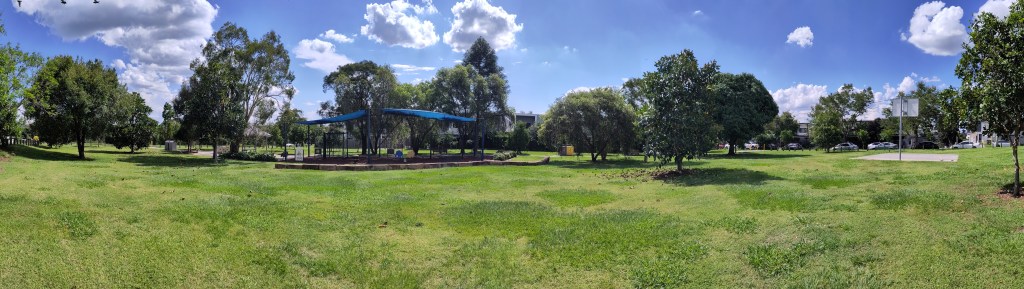
Quarry Park
In Salisbury there’s a park at 309-313 Lillian Avenue. A few years ago it was rather barren-looking and then the Council invested in some park benches and landscaping. However, there is no board naming the park.
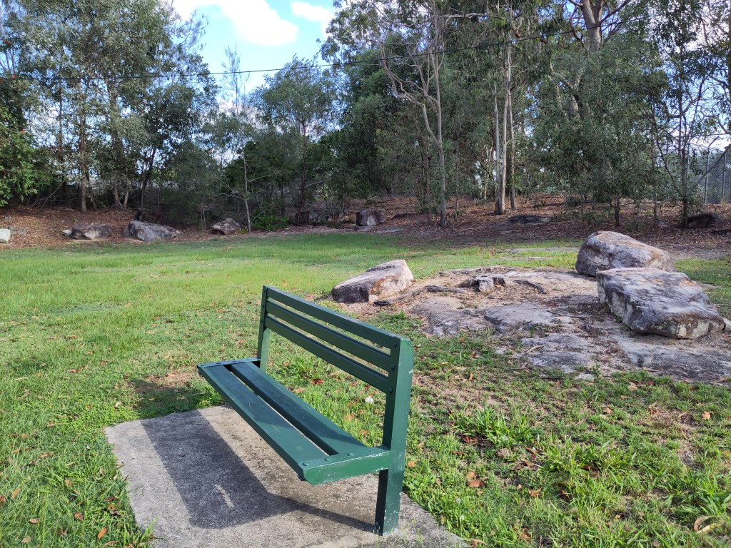


Council’s default name for parks without a specific name is the street it stands on. A few months ago, Barbara Ravenswood, President of the Moorooka History Group told me, Chair of the Coopers Plains History Group, that Cr Steve Griffiths had asked her to think of a name for Lillian Avenue Park. She passed the task on to me. I did some research and also cycled around the area talking to nearby residents. It turns out that the site was a quarry from the early 20th century that provided material to build many of the roads in Salisbury. Our History Group decided “Quarry Park” appropriately signified the history of the block, which is about 4,000 square meters. Neighbouring residents express satisfaction, some of who said, “we used to call it ‘the quarry’”.
After receiving our research, Cr Steve Griffiths’ office created a petition to name the park at 313 Lillian Avenue, Salisbury “Quarry Park”. An adequate number of signatories completed that process. The Coopers Plains History Group provided the following text for a history board to be placed in the park:
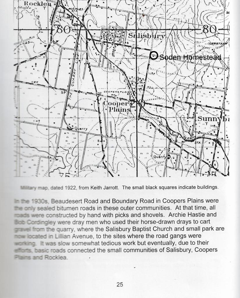
In the 1930s, Beaudesert Road and Boundary Road in Coopers Plains were the only sealed bitumen roads in these outer communities. Salisbury expanded east along Lillian Avenue. At the time, all roads were constructed by hand with picks and shovels. Archie Hastie and Bob Cordingley were dray men who used drays to cart gravel from a quarry on this site to where the road gangs were working. It was slow and somewhat tedious work but eventually, due to their efforts, basic roads connected the small communities of Salisbury, Coopers Plains and Rocklea.
We’re pleased that the workmen who helped build the suburb of Salisbury are honored in this way.
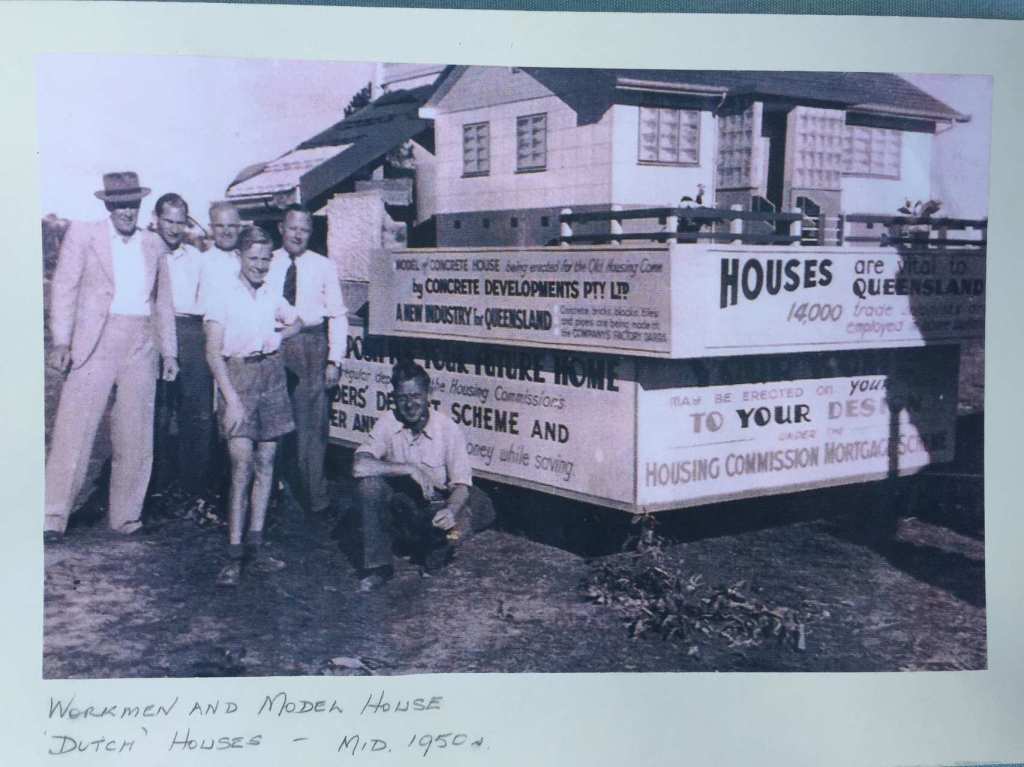
Dutch House Park
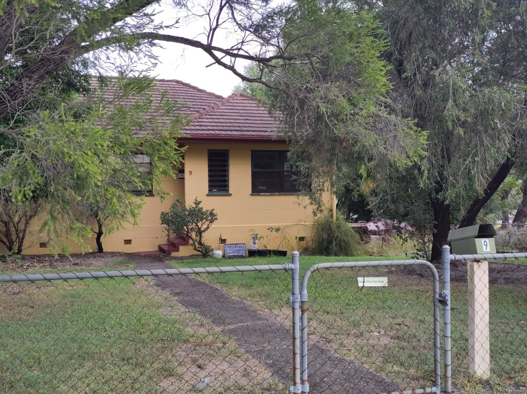
Since 2016, I have been lobbying for recognition and some preservation of the 1950s Housing Commission project in Coopers Plains known as the “Dutch Houses“. Some 300 of these homes were built by a Dutch company to accommodate the post war population boom. About 80 are left and fortunately six of the publicly tenanted homes have recently been listed for Heritage protection. This has been a major achievement. However, those homes are ‘out of the way’ and will never be on public display. For years, I advocated for one of the prime examples near the central park on McKoy Street created for the new Cornerstone Living development to be set aside as a History Cafe. This came to naught despite nearly 2,000 signatures on a petition and the backing of the Dutch Australia Cultural Centre.
I changed tack and asked the local City Council member, Kim Marx, if we could have a plaque located in the central park commemorating the Dutch Houses and giving a brief history. This was not supported.

After the experience of naming Quarry Park, in Salisbury, I struck on the idea of naming the park which is currently nameless, other than having the default reference ‘McKoy Street Park’, and which has no name board.
We have called for the central park in the Cornerstone Living development to be named “Dutch Houses Park”. It is central to the original Dutch Housing Project. We asked that a board be erected in the park with its name, basic history, two photos and a QR code. A draft of the history reads:
After the war, the ten hectares between Banoon and Coopers Plains Railway Stations this side of the line was the site of a significant public housing project in the early 1950s. Three-hundred concrete ‘Dutch Houses’ were constructed by the joint Australian-Dutch company, Concrete Developments Pty. Ltd. under contract to the Queensland Housing Commission. These houses were built from designs produced in The Netherlands during their post WWII recovery to address their housing shortage. Most of the materials and the machinery to make the concrete building blocks onsite were brought over from the Netherlands as were many of the labourers. The houses illustrate how QHC, established in 1945, sought to alleviate the housing shortage arising from Brisbane’s post-Second World War population growth and contributed to the City’s suburban development in the 1950s through collaboration with international contractors. Several examples remain nearby and a number of protected public houses are located on Lawford Street, Sunnybank, behind St Thomas Moore College.


The good news is that Cr Marx is all in favour of it and, with a petition signed by numerous local residents, it will go to Council’s first Committee meeting next year, on February 4th, for approval. The application to name Quarry Park will be considered at the same meeting.
soden homestead
Soden Homestead, In 1869, the Soden family built a homestead on the site where Hungry Jacks, Salisbury now stands. The Sodens, who ran an Omnibus business, were significant contributors to the development of southern Brisbane. The homestead was dismantled in 1982 when Raiwena Road was put through for the Commonwealth Games (Roberts, B. 2005. A Closer Look at Coopers Plains, p. 29 – 30). The Coopers Plains History Group wrote to Hungry Jacks management on 28th of November to inquire as to whether they would be amenable to placing a memorial plaque at their entrance. To date, no reply has been receved [sic].


Heritage Trails (history maps) Online
Sunnybank/Cooper Plains Heritage Trail We submitted to Council via Cr Kim Marx’s office, a
draft description for Council’s Heritage Trails in Sunnybank and Coopers Plains. We have
confirmed that brochures about the Heritage Trails are now available at the local Library and local
Ward Offices. We continue to advocate for history boards with QR codes in public places such as
parks and active transport routes (bicycle paths, etc.). The Heritage Trails can be found on the BCC
website at https://www.brisbane.qld.gov.au/things-to-see-and-do/experiences-and-culture/heritage-
trails. It’s a great resource – a veritable treasure trove of information!
Greater Brisbane City Council Centenary
Local history groups have come together to commemorate 100 years since the forming of the Greater Brisbane City Council in 1925. Brisbane is the biggest local government in the country. All the information about the commemoration and events are available HERE. Significant events are:
Community History Commemoration Day
Wednesday 1 October 2025
9:00 am 4:00 pm
Brisbane City Hall
History Conference at Brisbane City Hall
Saturday 11 October 2025
9:00 am 4:30 pm

Leave a comment